MacGregor Index Page.......... 2015 Bahama Trip Index Page
..........Previous Page......................................Next Page If There Is One
=========================================================
|
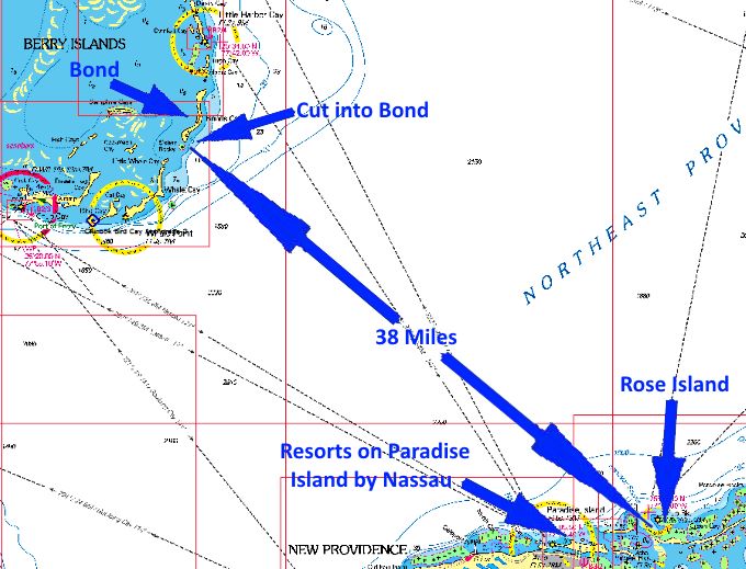
...................--- Rose Island (north side) ---................................ ..........................................................--- To --- ........................................--- Bonds Cay ---
|
.....................................................................................................
===============================================
|
....................................................(May 13th to 16th) Anchorage --- N 25º 29.299´ ==== Trip Mileage = 958 miles .7................W 77º 43.587´ ==== Day's Mileage = 44 miles |
===============================================
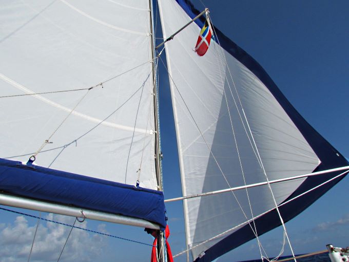
Today would be a deep water crossing of 40+ miles across the Northeast Providence Channel to the Berry Islands, Bond Cay to be specific. I was underway at 7:45 am and motored about a mile out and pulled the outboard up and headed under sail in a NW direction with the main on the first and only reef point and the Genoa all the way out. The Mac averaged about 4-5 ....
.... passing to the north of Nassau and Paradise Island above. As the morning wore on the wind died and the seas went flatter than shown above with 2-3 foot widely spaced swells that the boat just road up and down on. I then went first to a full main and the Genoa wing on wing and then as the wind came back to running not wing on wing. The winds were lighter than the 14-16 that were predicted.
Around 10 am I was back to running wing on wing again and as noon approached the winds started to pick up and ....
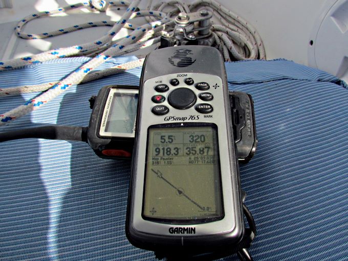
..... the boat was running 5+ most of the time. I was also over 900 miles for the trip at this point. It seemed a little strange to be back in inky blue water again after being in the beautiful Bahamian shallow water for the past few weeks.
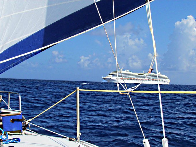
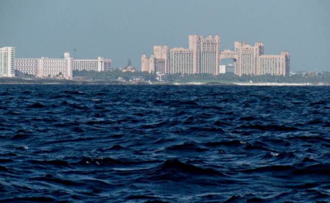
North of Paradise Island some ways a large cruise ship approached from the east and ....
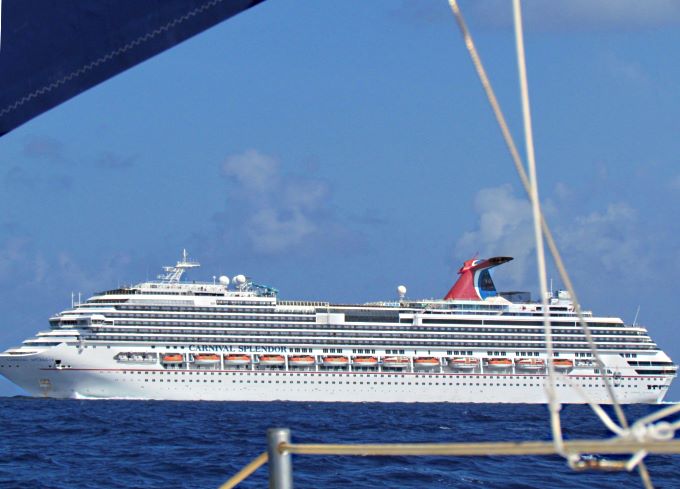
.... ran by me not that far off the bow....
... actually closer than what I thought he had to....
... considering once past me he immediately made a turn to the south and ran to Nassau. He could of made the turn a few minutes earlier and ran south of me and off my stern. I continued north towards the cut on the south end of Bond Cay and could start to see the Berry's about 9 miles out. Earlier I had seen the tall buildings on Paradise Island much further off shore. Still you will be out of sight of any land for some ways on this passage. I did talk briefly to one boat headed south and another headed north but other than those two and the cruise ship no one else.
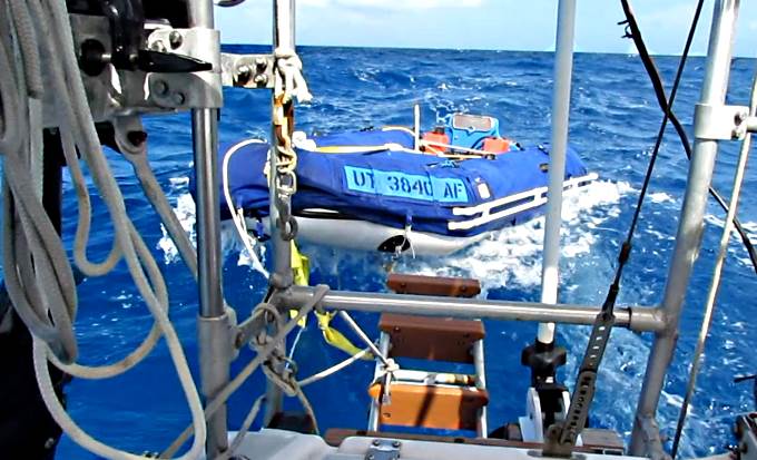
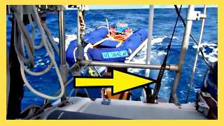
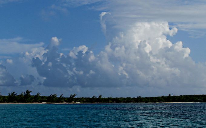
Most of the day I had following waves but not as large as the day before. As I approached the cut into Bond the following waves did increase in size and frequency as shown above with the dinghy ridding higher than the back of the Mac at that moment.
.........................................
Click (HERE) or on the photo above to see how the larger following waves were effecting the dinghy the last part of the run into the cut when I had switched from sailing to the outboard. Notice the snapping action on the dinghy's tow strap. I think of some of the days like this if I would of been towing the dinghy from the bow rings I might of pulled them out. Pulling from the transom aliviates that concern. More on that (HERE).
The larger seas were a result of the wind picking up as I approached the cut into Bond.
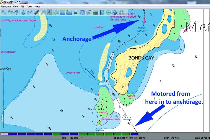
About 2 miles out of the cut into Bond after running the previous 35 miles under sail I dropped the main and continued on the Genoa after dropping the outboard back into the water. I started running the outboard as I wanted to make sure I didn't push any limits going into and through this cut with reefs on both sides of it. Just before the area with the reefs I pulled the Genoa in and proceeded with just the outboard. Underwater visibility to port was bad with respect to seeing the reef there due to the sun angle and the waves so I stayed to starboard and ran closer to the reef there as I could read the water better in that direction. I made it through the cut and into the calm waters in the channel behind it with no drama.
I motored about 2 miles north ....
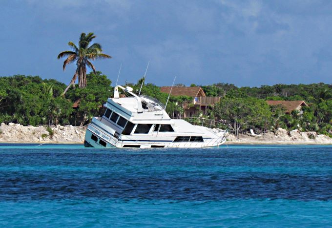
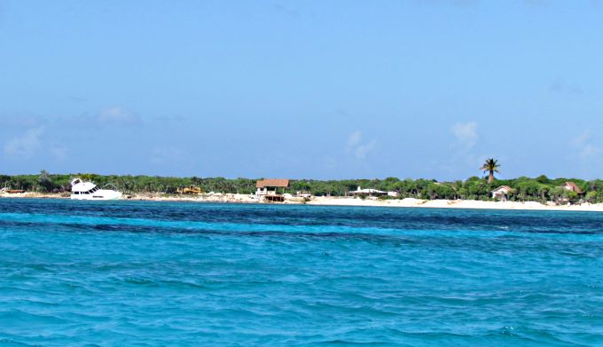
... along the west side of Bond. Evidently the boat above at some point did experience some drama. Views like the one above do remind you that if you are not careful things can go wrong.
I finally put the anchor down not far off shore and just to the north of a couple other boats on the anchorage, a cat and a trawler.
A front was going to be moving through with predicted 20-30 mph winds so the plan was to spend a couple days here until it passed as the anchorage gave pretty good protection from the east winds that were coming. I feel asleep reading a book about 7 pm and woke up at 11:30 pm with the boat all opened up but it wasn't full of bugs so closed things up and went back to sleep and continued sleeping to 7 am the following morning. I was tired.
With the screened pop-top cover I had no bug problems anywhere on the trip, not in Florida and not in the Bahamas. I did have a few welts while in Florida so think I might of been bit by no-see-ums during the day a few times.
I just hung around for the next couple days (14th, 15th and 16th) waiting out the high winds.
I did take a short dinghy ride north along the shore to a very small bay a ways north one of the days. Of interest on the way back was that I saw what appeared to be a rather large stream running out of the brush along the shore and down into the water. The best I could tell was that it wasn't a stream that ran all the time but with the tidal swings. The chart shows a marsh area just inland at that point with some ponds. I think at high tide the water flows into that area and when the tide goes out it flows back out again and creates this saltwater stream.
On one of the days there was a boat anchored at the north end of Bond and one of the boats by me talked to them via the radio and suggested that our anchorage was more settled than the one to the north and recommended they come down to us on a deeper water channel that runs a ways out along the west side of Bond. They did make the move and I decided that I would use the same route when I moved north up to Little Harbor Cay.
=========================================================
........................................................................................Next Page If There Is One...